Batteries, first aid kit, flashlight, important papers, app call zello for walkie talkie, cash, water food. If in car sitting use air conditioner total 10 minutes within hour
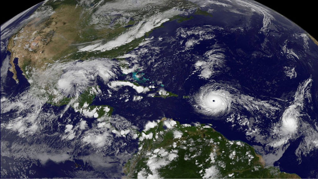
The 2017 Atlantic hurricane season is an ongoing event in the annual formation of tropical cyclones in the Atlantic basin. This season featured the first major hurricane to make landfall in the contiguous United States since Wilma of the 2005 season, Hurricane Harvey, which caused 51.88 in (1,318 mm) of rainfall in Texas, the highest-ever rainfall total for any Atlantic tropical cyclone in the United States and the fifth highest rainfall total for a tropical cyclone in the Atlantic basin. It also featured Hurricane Irma, the strongest hurricane ever to form in the Atlantic Ocean outside of the Gulf of Mexico and Caribbean Sea.
The season officially began on June 1 and will end on November 30. These dates historically describe the period of year when most tropical cyclones form in the Atlantic basin and are adopted by convention. However, as shown by Tropical Storm Arlene in April, the formation of tropical cyclones is possible at any time of the year.
For the third consecutive year, activity began early, with the formation of Tropical Storm Arlene on April 19, nearly a month and a half before the official start of the season. It is only the second named storm on record to exist in the month of April, with the first being Ana in 2003, as well as the strongest overall for the month of April. In mid-June, Tropical Storm Bret struck the island of Trinidad, which is rarely impacted by tropical cyclones due to its low latitude. Tropical Storm Cindy struck the state of Louisiana a few days later, becoming the first tropical cyclone to strike the state since Hurricane Isaac in 2012. In late August, Hurricane Harvey became the first major hurricane to make landfall in the United States since Wilma in 2005. In early September, Hurricane Irma, a Cape Verde-type hurricane, became the first Category 5 hurricane to impact the northern Leeward Islands on record, as well as the joint strongest hurricane ever to make landfall in the Atlantic basin, tied with the 1935 Labor Day hurricane.
Beginning this year, the National Hurricane Center has the option to issue advisories, and thus allow watches and warnings to be issued, on disturbances that are not yet tropical cyclones but have a high chance to become one, and are expected to bring tropical storm or hurricane conditions to landmasses within 48 hours. Such systems are termed “potential tropical cyclones”. Advisories on these storms contain the same content, including track forecasts and cyclone watches and warnings, as advisories on active tropical cyclones. This was first demonstrated on June 18 with the designation of Potential Tropical Cyclone Two—which later developed into Tropical Storm Bret—east-southeast of the Windward Islands.

